|
|
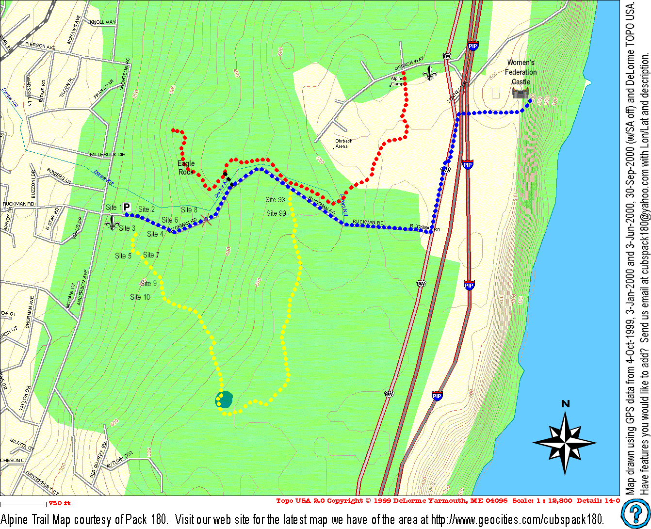
| Map of Northern New Jersey Council Camp Alpine trails. This map was drawn using
GPS data from 4-Oct-1999, 3-Jan-2000, 3-Jun-2000, and 30-Sep-2000 using DeLorme TOPO
USA. The data for this map from the GPS satellites was taken with selective
availability (SA) off. Accuracy is ±50 feet. The map below covers the Red and
Gold trails. The Blue/White trail is Ruckman Rd. The map shown below (in GIF format - 258K) is also available as a PDF file - AlpineTrailMap.PDF (240K). |
 |
 <== Click on map to
view full size (258K).
<== Click on map to
view full size (258K).| Map Revision History | |
|---|---|
| 15-Oct-2000 | Full Red trail added. |
| 2-Aug-2000 | Enhanced formatting, easier to read map. Add partial red trail to Eagle Rock. |